Explore the World of 1800: Detailed Historical Maps Now Available at the Map Archive"
Explore the World Map of 1800, showcasing detailed geography and political boundaries of the early 19th century, available exclusively at the Map Archive.
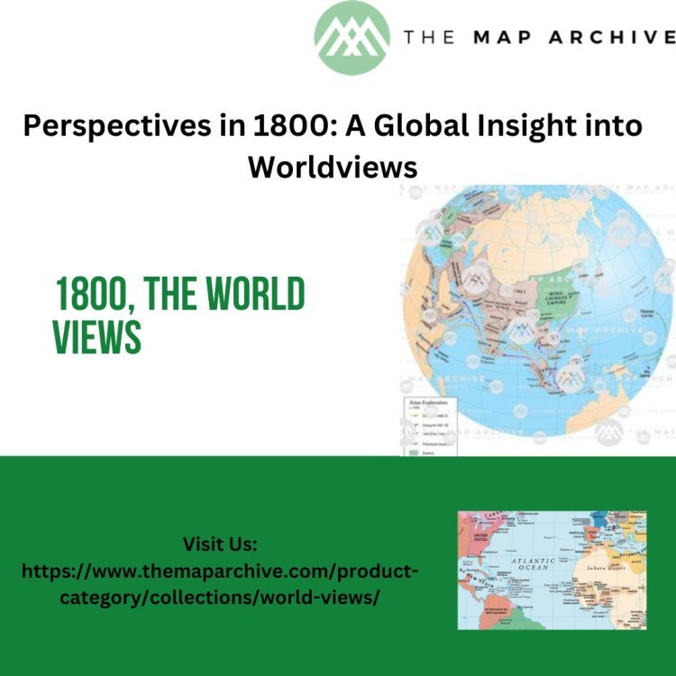
Maps are more than just navigational tools; they are windows into the past, revealing how our ancestors viewed and understood their world. The World Map of 1800, available at The Map Archive, is a fascinating artifact that offers a unique snapshot of the geopolitical landscape at the dawn of the 19th century. This period was marked by significant political, social, and economic transformations that shaped the modern world. By exploring this map, we can gain insights into the empires, nations, and territories that defined the era and understand the historical context that influenced their boundaries and interactions.
The Political Landscape of 1800
The year 1800 was a pivotal moment in history, characterized by the dominance of powerful empires and the emergence of new nations. One of the most prominent features of the 1800 world map is the vast expanse of the British Empire. At the time, Britain was the preeminent global power, with colonies and territories stretching across North America, the Caribbean, Africa, Asia, and the Pacific. The map illustrates the extent of British influence, highlighting regions such as Canada, India, and Australia, which were integral parts of the empire.
In Europe, the map reveals a continent in flux. The Holy Roman Empire, a complex and fragmented political entity that had existed for nearly a millennium, was on the brink of dissolution. The map captures the intricate patchwork of states, principalities, and free cities that comprised the empire, reflecting the decentralization and fragmentation that characterized its final years. Meanwhile, France, under the leadership of Napoleon Bonaparte, was rapidly expanding its influence. The map shows the territorial gains made by France during the Revolutionary Wars, setting the stage for the Napoleonic Wars that would dominate the early 19th century.
The Americas: A Continent in Transformation
The map of the Americas in 1800 presents a continent undergoing significant change. In North America, the young United States had recently doubled its territory through the Louisiana Purchase, although this acquisition is not yet reflected on the map as it occurred in 1803. Instead, the map shows the original thirteen states and the Northwest Territory, highlighting the nascent nation's expansionist ambitions. Spanish territories, including New Spain (modern-day Mexico and the southwestern United States), are prominently featured, showcasing Spain's extensive colonial holdings.
South America, too, is depicted as a region of colonial dominance. The map highlights the vast territories controlled by Spain and Portugal, including the Viceroyalty of New Granada, the Viceroyalty of Peru, and the Viceroyalty of the Río de la Plata. However, this period also marks the beginning of the independence movements that would sweep across the continent in the early 19th century. Figures like Simón Bolívar and José de San Martín were beginning to emerge, leading the charge for liberation from colonial rule.
Africa and Asia: Centers of Commerce and Conflict
The map of 1800 also provides a glimpse into Africa and Asia, regions that were centers of commerce and conflict during this period. In Africa, European powers were primarily focused on coastal areas, engaged in the transatlantic slave trade and the exchange of goods such as gold, ivory, and spices. The map shows the presence of European trading posts and forts along the West African coast, reflecting the continent's role in global trade networks. Inland, the African continent is depicted with limited detail, illustrating the Eurocentric perspective of the time and the lack of comprehensive exploration and mapping of the interior regions.
Asia, on the other hand, is portrayed with greater specificity, particularly in regions where European powers had established significant footholds. The British East India Company is prominently featured, controlling vast territories in the Indian subcontinent. The map highlights key regions such as Bengal, Madras, and Bombay, which were under British control and served as major centers of trade and administration. Other colonial powers, including the Dutch and the French, are also represented, with territories in Southeast Asia and the Indian Ocean.
China and Japan, though not colonized, are shown as significant players in the regional balance of power. The Qing Dynasty ruled over China, maintaining a policy of limited interaction with European powers through controlled trade at ports like Canton. Japan, under the Tokugawa shogunate, remained largely isolated from the outside world, adhering to its policy of sakoku, which restricted foreign influence and trade.
The Pacific and Oceania: Exploration and Colonization
The Pacific and Oceania regions are depicted on the 1800 world map as areas of exploration and emerging colonization. The British Empire's presence in Australia is evident, with the establishment of the penal colony at Sydney Cove in 1788 marking the beginning of British settlement. The map shows the eastern coastline of Australia, known as New South Wales, as part of the British Empire, reflecting the early stages of colonization that would eventually encompass the entire continent.
The Pacific islands are represented with varying degrees of detail, showcasing the extent of European exploration during the Age of Discovery. Islands such as Tahiti, Hawaii, and Fiji are marked, indicating the growing European interest in the Pacific for trade, whaling, and missionary activities. The map also hints at the geopolitical rivalries between European powers as they vied for control and influence in these distant territories.
Indigenous Peoples and Cultural Landscapes
While the 1800 world map provides a detailed account of the political and territorial divisions of the time, it also serves as a reminder of the diverse cultures and indigenous peoples who inhabited these regions long before European colonization. In North America, the map does not fully capture the rich tapestry of Native American tribes and their complex societies. Similarly, in Africa, Asia, and Oceania, the indigenous populations and their cultures are often marginalized or overlooked in favor of depicting European claims and interests.
Indigenous peoples played crucial roles in the historical narratives of these regions, often resisting colonization and maintaining their cultural identities despite external pressures. The map serves as a starting point for exploring these stories, prompting us to consider the broader human experience beyond the geopolitical boundaries and colonial perspectives of the time.
Technological and Scientific Advancements in Cartography
The creation of the 1800 world map was made possible by the technological and scientific advancements in cartography that occurred during the 18th century. The Age of Enlightenment had fostered a spirit of exploration and discovery, leading to improved mapping techniques and a better understanding of the world's geography. Innovations such as the use of longitude and latitude, more accurate surveying methods, and the development of detailed sea charts contributed to the accuracy and comprehensiveness of maps produced during this period.
Cartographers like James Cook and Alexander von Humboldt made significant contributions to the field, conducting extensive explorations and surveys that expanded the geographical knowledge of their time. The 1800 world map reflects the cumulative efforts of these explorers and cartographers, providing a detailed and accurate representation of the known world.
Conclusion: The Legacy of the 1800 World Map
The World Map of 1800, available at The Map Archive, is more than just a historical artifact; it is a testament to the dynamic and transformative nature of the early 19th century. By examining this map, we gain valuable insights into the political, social, and economic forces that shaped the world at that time. The map captures the rise and fall of empires, the beginnings of nation-states, and the complexities of colonialism and indigenous resistance.
As we reflect on the world of 1800, we are reminded of the interconnectedness of human history and the enduring impact of past events on our present and future. The map serves as a bridge between the past and the present, inviting us to explore and understand the historical context that has shaped the world we live in today. Through this exploration, we can appreciate the rich tapestry of human experience and the ongoing journey of discovery and knowledge that continues to define our world.
What's Your Reaction?


![Wireless Connectivity Software Market Size, Share | Statistics [2032]](https://handyclassified.com/uploads/images/202404/image_100x75_661f3be896033.jpg)


