Exploring the Historical US Presidential Election Maps: A Journey Through American Democracy
Election Trends Over Time: Delve into the evolution of voting patterns with maps that highlight the shifts in political dominance and regional preferences from the early 19th century to the present.
The US presidential elections map are a cornerstone of American democracy, representing the voice of the people and the principles of a republic. As each election unfolds, the results are meticulously recorded and often depicted in maps that illustrate the shifting political landscape of the nation. These maps are not just tools for visualizing electoral outcomes; they are rich historical documents that reflect the evolving dynamics of American politics, society, and geography.
One of the most comprehensive resources for these historical maps is the Map Archive, a treasure trove of visual data that chronicles the presidential elections from the inception of the United States to the present day. This archive provides a unique lens through which we can examine the progression of political ideologies, the impact of social movements, and the shifting allegiances of states and regions over time. In this guest post, we will delve into the significance of these maps, explore key moments in US electoral history, and understand how these visual aids can enhance our comprehension of American political evolution.
The Significance of Election Maps
Election maps are crucial for several reasons. First, they offer a visual representation of complex data, making it easier to understand at a glance the distribution of electoral votes, the winning party, and regional political preferences. Second, they provide historical context, allowing us to track changes over time and correlate them with significant events in American history. Third, they serve as a tool for education and analysis, helping students, scholars, and the public to engage with the electoral process in a more meaningful way.
The Map Archive is particularly valuable because it compiles maps from every presidential election, offering a continuous narrative of American political history. From the first election in 1789, where George Washington was unanimously elected, to the most recent elections, these maps chart the course of American democracy, highlighting both continuity and change.
Key Moments in US Electoral History
The Early Years (1789-1824)
The early presidential elections set the foundation for the American political system. The first election in 1789 was unique, as George Washington was elected unanimously by the Electoral College, reflecting his unchallenged leadership during the nation's founding period. Maps from these early elections show a nascent nation, with only 13 states participating initially and then gradually expanding as new states joined the Union.
The election of 1800, often referred to as the "Revolution of 1800," was a pivotal moment. Thomas Jefferson's victory over incumbent John Adams marked the first peaceful transfer of power between political parties, a critical test for the young democracy. The maps from this election highlight the sectional divide between the Federalists and the Democratic-Republicans, foreshadowing future regional conflicts.
The Civil War and Reconstruction (1860-1876)
The election of 1860, in which Abraham Lincoln was elected, is one of the most significant in American history. The map of this election starkly illustrates the division between the Northern states, which largely supported Lincoln, and the Southern states, which did not. Lincoln's victory, without carrying a single Southern state, underscored the sectional tensions that would soon erupt into the Civil War.
Following the Civil War, the elections during the Reconstruction era show the struggles of integrating the Southern states back into the Union. The maps from this period reveal the complex dynamics of a nation attempting to rebuild and reconcile. The contested election of 1876, resulting in the Compromise of 1877, effectively ended Reconstruction and had long-lasting implications for race relations and political power in the South.
The Progressive Era to World War II (1896-1944)
The turn of the 20th century brought significant political and social changes. The election of 1896, where William McKinley defeated William Jennings Bryan, marked the end of the Populist movement and the beginning of a Republican dominance that would last for several decades. The maps from this period reflect the industrialization and urbanization of America, with political power increasingly concentrated in the burgeoning cities.
The elections during the Great Depression and World War II highlight the dramatic shifts in political allegiance and ideology. Franklin D. Roosevelt's landslide victories in the 1930s and 1940s, as shown in the maps, reflect the widespread support for his New Deal policies and wartime leadership. These maps also illustrate the realignment of political parties, with African Americans and other minorities increasingly supporting the Democratic Party.
The Civil Rights Movement and Modern Era (1960-Present)
The election of 1960, one of the closest in history, saw John F. Kennedy narrowly defeating Richard Nixon. The maps from this election underscore the emergence of television as a powerful medium in politics, as well as the beginning of the modern era of closely contested elections.
The 1964 election, where Lyndon B. Johnson won in a landslide against Barry Goldwater, is notable for the regional realignment it presaged. Johnson's support for civil rights legislation led to a significant shift in the South, which had been a Democratic stronghold but began to move towards the Republican Party.
In recent decades, the election maps have continued to reflect the deepening polarization of American politics. The contentious elections of 2000 and 2016, for example, highlight the increasing importance of swing states and the profound impact of demographic changes. The 2008 election of Barack Obama, the first African American president, marked a historic moment, with maps showing widespread support across diverse regions and demographics.
Analyzing the Trends
Examining the maps in the Map Archive reveals several key trends in US presidential elections:
Regional Shifts: Over time, certain regions have shifted their political allegiances dramatically. The Solid South, once a Democratic bastion, has become reliably Republican, while the Northeast and West Coast have trended Democratic.
Urban vs. Rural Divide: The growing divide between urban and rural areas is evident in the maps. Cities and metropolitan areas increasingly lean Democratic, while rural regions tend to support Republican candidates.
Swing States: The importance of swing states in determining the outcome of elections has become more pronounced. States like Florida, Ohio, and Pennsylvania often serve as the battlegrounds that can tip the balance in close elections.
Demographic Changes: Shifts in the demographic makeup of the electorate, including the growing influence of minority voters, have significantly impacted election outcomes. The maps reflect these changes, particularly in states with rapidly changing populations.
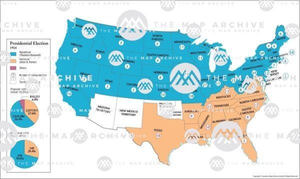
Third-Party Influence: While third-party candidates rarely win significant electoral votes, their influence can be seen in certain elections. The maps from elections like 1912, where Theodore Roosevelt ran as a Progressive, or 1992, where Ross Perot garnered a substantial share of the popular vote, show the potential impact of third-party campaigns.
The Educational Value of Election Maps
The historical election maps available in the Map Archive serve as invaluable educational tools. For educators, these maps can bring history to life, providing students with a visual and interactive way to explore the evolution of American politics. By analyzing these maps, students can gain insights into the factors that shape electoral outcomes, such as economic conditions, social movements, and demographic trends.
For researchers and historians, the maps offer a rich dataset for studying the long-term trends and patterns in US elections. They can be used to examine questions about political realignments, voter behavior, and the impact of specific events or policies on electoral outcomes.
For the general public, these maps enhance understanding and engagement with the electoral process. They offer a way to see beyond the headlines and understand the broader context of each election, fostering a deeper appreciation for the complexities of American democracy.
Conclusion
The US presidential election maps available in the Map Archive are more than just historical artifacts; they are windows into the past that help us understand the present and anticipate the future. By exploring these maps, we can gain a deeper appreciation for the rich tapestry of American political history and the enduring principles of democracy that guide the nation. Whether for education, research, or personal interest, these maps are an invaluable resource for anyone seeking to understand the ever-evolving landscape of US presidential elections.
What's Your Reaction?


![Wireless Connectivity Software Market Size, Share | Statistics [2032]](https://handyclassified.com/uploads/images/202404/image_100x75_661f3be896033.jpg)


